

Quick answer
Island hopping oslo public transport requires only a standard 59 NOK Ruter ticket, valid across zone 1 metro, tram, bus lines and all passenger ferries departing from Rådhusbrygge 4 in central Oslo. The ticket remains active for 60 minutes from validation, enough time to transfer from metro or tram to the ferry pier. Ferries operate daily from early morning through evening, with no advance booking required for foot passengers.
Oslo operates one of the few capital-city ferry networks where the vessel is simply another numbered route on the transit map. The same ticket scanner you tap at a metro turnstile works on the gangway of a B-numbered ferry line, and the fare structure makes no distinction between a ride to Bygdøy and a crossing to Hovedøya or Gressholmen. This integration dates to Ruter's 2008 formation, when the city merged its land and water transit operators under a unified fare zone. The Rådhusbrygge pier sits 300 meters from the Rådhuset metro station, reachable via the plaza behind Oslo City Hall. Most island-bound ferries depart from pontoons B3 and B4, marked by yellow signage and real-time departure boards synced to Ruter's app. Lines B1 through B4 serve the inner fjord archipelago year-round, with frequencies peaking at 15-minute intervals during summer weekends and stretching to 45 minutes on weekday mornings in autumn. No timetable segregates tourists from commuters — residents of Lindøya and Nakholmen use the same ferries as day visitors, and cabin-owners boarding with groceries share deck space with hikers carrying tent poles. Navigating island hopping oslo public transport demands attention to zone boundaries and transfer windows. A single-zone ticket covers all inner-fjord islands, but passengers arriving from Oslo Airport or outer suburbs may need a two-zone fare, validated before boarding the metro toward the city center. The 60-minute transfer window begins at first validation, not at the ferry pier, so travelers starting from Majorstuen or Grønland should confirm their ticket remains active before tapping onto the boat. Ruter's app displays a countdown timer, and pier staff rarely check expired tickets until the return journey when queues form at the gangway scanner. Ferry routes split at Vippetangen, a secondary pier 1.2 kilometers south of Rådhusbrygge, used by line B4 to Langøyene during peak season. No direct metro service reaches Vippetangen, requiring a 12-minute walk from Jernbanetorget or a bus connection via route 60. Most first-time visitors stick to Rådhusbrygge departures, which cover Hovedøya, Gressholmen, Lindøya, Nakholmen and Bleikøya without requiring a route transfer. The system's simplicity — one ticket type, one validation method, one departure zone — removes the friction that typically surrounds island access in Nordic capitals where private operators dominate. Weather and vessel maintenance suspend service without advance notice, particularly on shoulder-season weekdays when a single ferry serves multiple routes. Ruter's real-time API updates within five minutes of a cancellation, but the pier's analog departure board lags by 15 to 20 minutes, leading to crowded waits when a delayed boat finally docks. Locals check the app before leaving home; visitors arriving at an empty pier often assume they've missed the last departure when the next ferry simply runs late.
“The same ticket scanner you tap at a metro turnstile works on the gangway of a B-numbered ferry line.”
Starting Island Hopping Oslo Public Transport at Rådhusbrygge
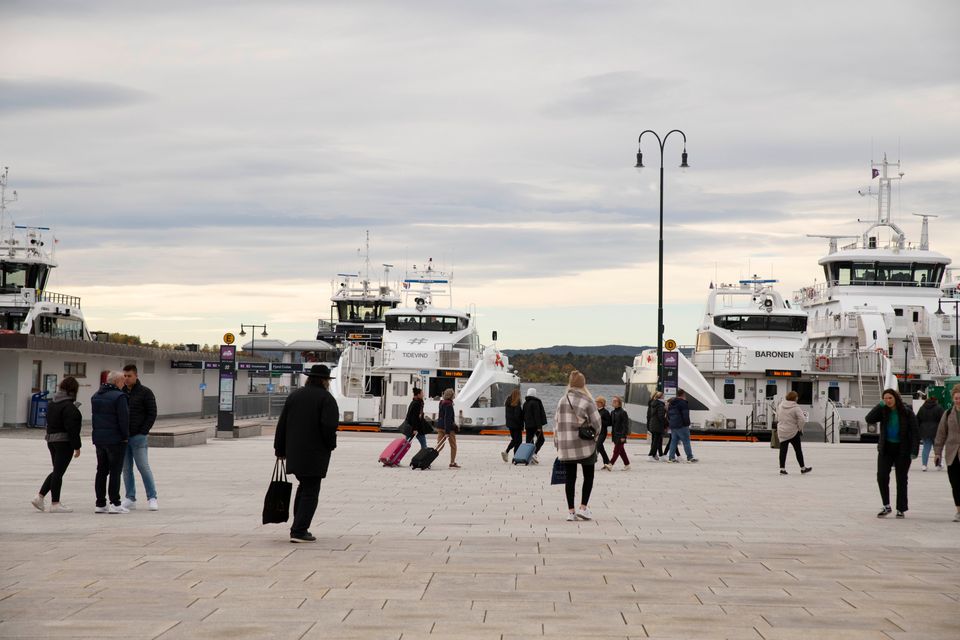
The public ferry network for the Oslo islands departs from Rådhusbrygge 4, located directly in front of the Oslo City Hall. This central waterfront location is accessible via the city's integrated public transport system.
Line 12 to Rådhusplassen
Line 1-5 to Nationaltheatret
From Oslo Central Station
Best Time for Island Hopping Oslo Public Transport
The best arrival window for island hopping is 09:00–11:00, when ferries are less crowded and islands open before the midday visitor peak. Visiting during this time ensures a more predictable experience across the Oslo Fjord.
Summer (June-August)
HighWarm, 15–22°C
Long daylight hours allow for extended exploration but ferries experience heavy passenger volume.
Weekday mornings
Low—
Mid-week mornings offer the quietest transit experience before local crowds increase.
Spring/Autumn (April-May, Sept-Oct)
ModerateCool, 5–15°C
Fewer visitors arrive during these shoulder months, providing more space on the ferries.
Winter (November-March)
Very lowCold, -5–5°C
Service operates, though limited daylight and cold temperatures reduce outdoor activity time.
Planning Your Itinerary for Island Hopping Oslo Public Transport
This plan suits first-time visitors with a full day to explore two islands using Ruter ferries. Budget six hours for travel, walking, and island time.
Depart Rådhusbrygge 4
Board the B3 or B4 ferry from the City Hall pier with your 59 NOK Ruter ticket. Ferries run every 30–60 minutes depending on the route.
Arrive Hovedøya
Explore the medieval monastery ruins and walk the forest trails. Allow two hours to cover the main paths and shoreline.
Ferry to Gressholmen
Catch the connecting ferry from Hovedøya's pier. The crossing takes 15 minutes; check the Ruter app for the next departure.
Explore Gressholmen
Walk the grassy airfield and visit the small beach on the western side. One hour covers the island's compact layout.
Return to Rådhusbrygge 4
Board the return ferry to Oslo city center. The journey takes 20 minutes, arriving before the afternoon crowd.
Check availability
Frequently asked questions about island hopping in Oslo Fjord
Everything you need to know about island hopping oslo public transport